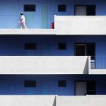
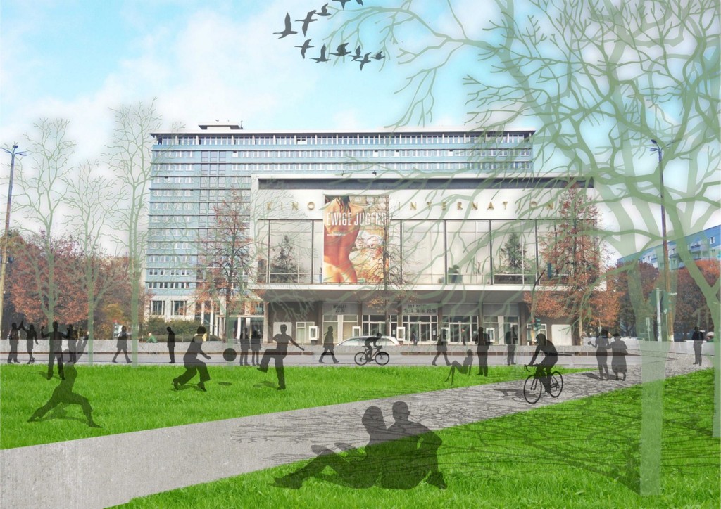
INTRODUCTION: The Karl-Marx-Allee is a monumental socialist boulevard built by the GDR between 1952 and 1960 in Berlin Friedrichshain and Mitte. Originally named Stalinallee between 1949 and 1961 (previously Große Frankfurter Straße), it was a flagship building project of East Germany’s reconstruction programme after World War II. Designed to contain spacious and luxurious apartments for plain workers, as well as shops, restaurants, cafés, a tourist hotel and an enormous cinema (Kino International), this iconic boulevard has lost much of its charm through the decades. The boulevard today, with its heavy car infrastructure disconnects the neighbourhoods from themselves and the city. The Design Proposal offers a variety of functions that repair these broken connections as well as provide a platform for exchange between these neighbourhoods and the rest of the city. The proposal focuses on creating an ‘Urban Social Space’ that offers Private (spaces shared by the neighbourhoods), Semi-Private (Pavilions and open spaces) and Public spaces (Markets, Exhibition spaces, Sports infrastructure, Landscaped areas).
Architect: Hamed Khalidi
University: Dessau
Country: Germany
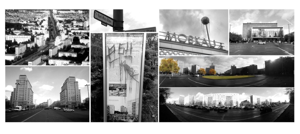
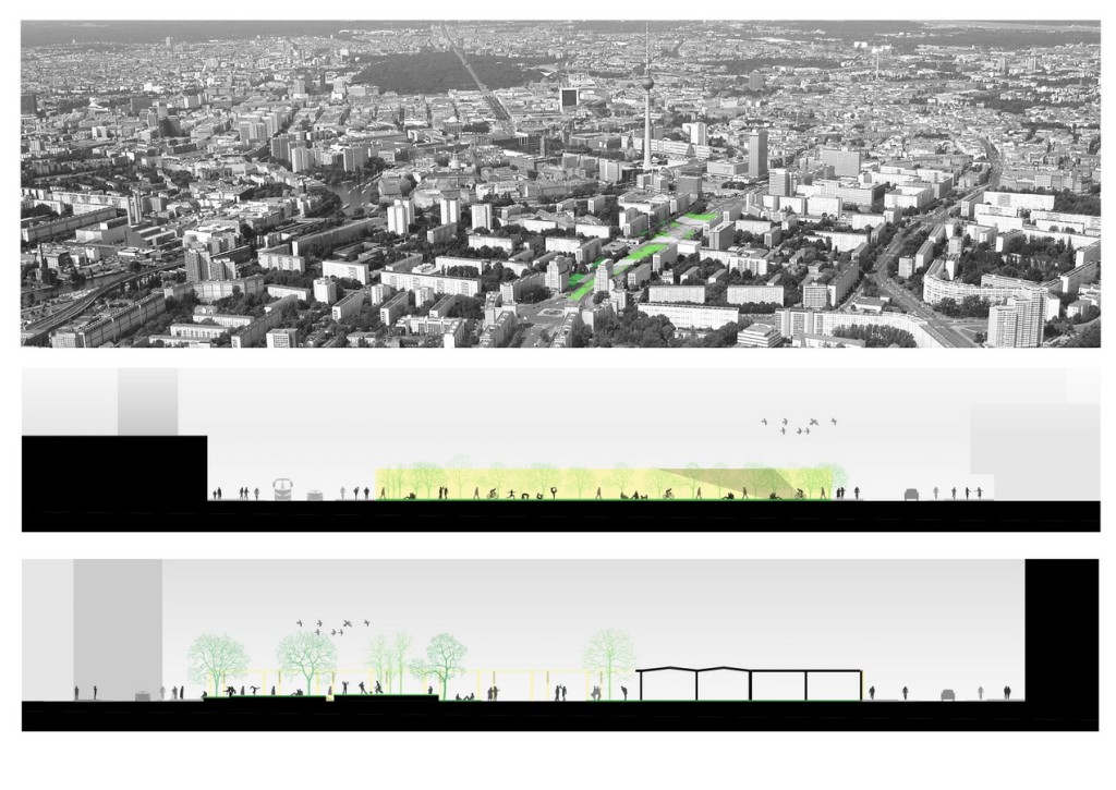
THE BOULEVARD TODAY: ENORMOUS WIDTH OF ROADS: The avenue, which is 89 m wide and nearly 2 km long, is lined with monumental eight-storey buildings designed in the wedding-cake style, the socialist classicism of the Soviet Union.
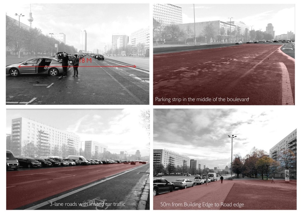
THE 18M WIDE PARKING STRIP: Despite it having found favour with postmodernists, the Boulevard today is prey to the automobile infrastructure, thus making its inherent function and purpose devoid. A nightmare for the accessibility of pedestrians, as well as a nuisance for the residents with a 18m wide parking strip in the middle of the boulevard.
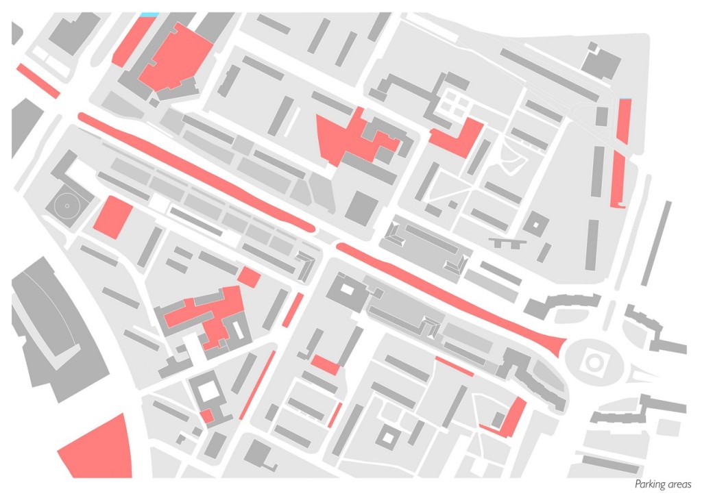
DISCONNECTION & ISOLATION FOR ITS NEIGHBOURS AND RESIDENTS: The Boulevard offers lavish promenades and green spaces in front of the apartment buildings. However, the enormous width of the road as well as the massive parking strip in the middle has left its residents disconnected and isolated from each other. While the landscape areas are aplenty, they act as islands in a sea of cars, making them inaccessible and unusable.
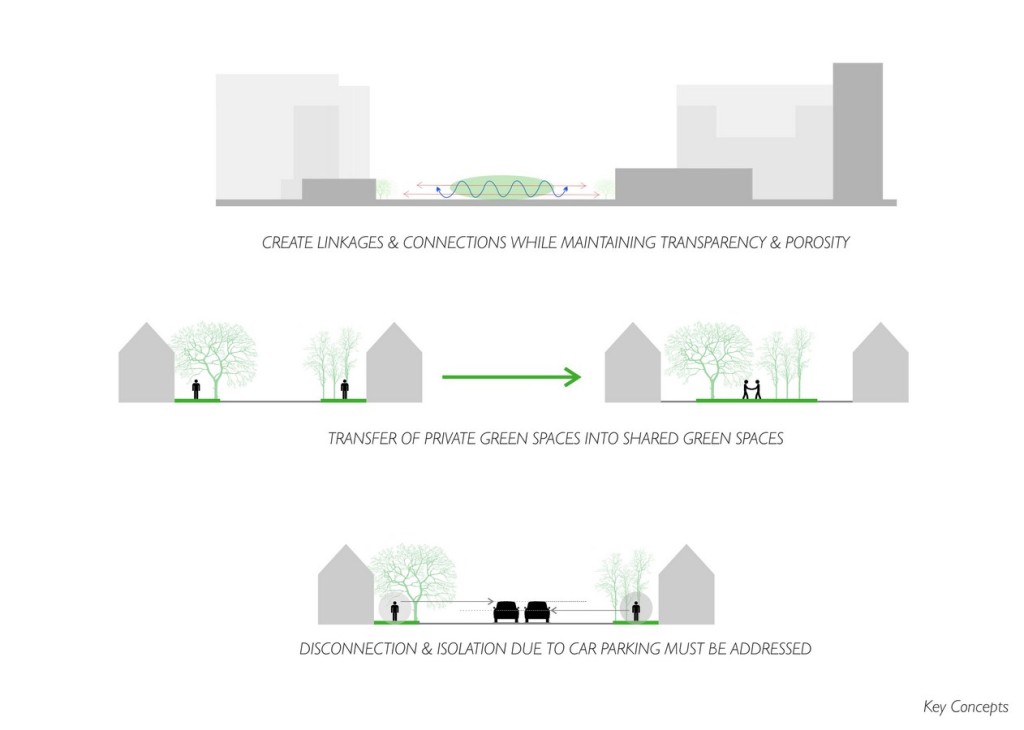
CONCEPTS: The design attempts to create a platform for interaction for neighbourhood residents using landscape areas and urban social spaces. This is achieved by adding little in terms of built form thus allowing a transparent and porous environment for the neighbourhood to access.
The Design stems from the notion of interconnections between residents and thus uses the physical linkages as the design guidelines for form and function.

LINKAGES AND CONNECTIONS: The core concept of the design is to repair the links and connections between neighbourhoods on either side of the boulevard, and this is done by physically and visually linking them together thus creating a cross-grid along the boulevard. These links act as pedestrian pathways that connect with each other, intersecting at various points creating the opportunities for spontaneous social engagements.
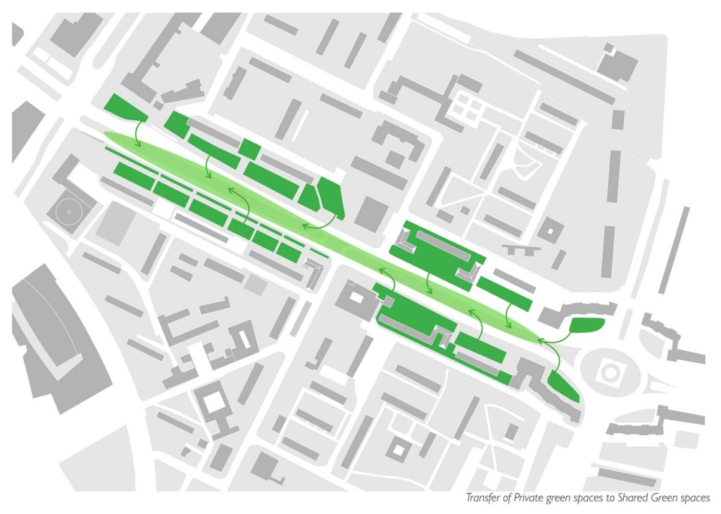
TRANSFER OF PRIVATE GREEN SPACES INTO SHARED GREEN SPACES: The lavish landscape areas for the residents are grossly out of proportion, thus making them unusable and nearly un-humane. The Design attempts to combine the individual landscape areas and transfer them into central shared spaces that can be viewed, accessed and enjoyed by all residents of the neighbourhood.
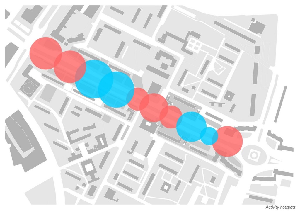
ZONING AS PER ACTIVITY LOCATION: The Activity Map for the Design has been charted using the Fabric Map of the neighbourhood. More public activities are planned along the edges, thus linking it with the rest of the city, while the private functions are scattered around the boulevard based on proximity to residential areas.
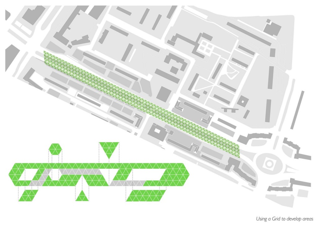
DEVELOPMENT OF THE GRID: A triangular grid is used to create various iterations of space, while ensuring the linkages and connections between neighbourhoods. This grid further adheres to the existing activities within the context, while developing new functions for the boulevard.
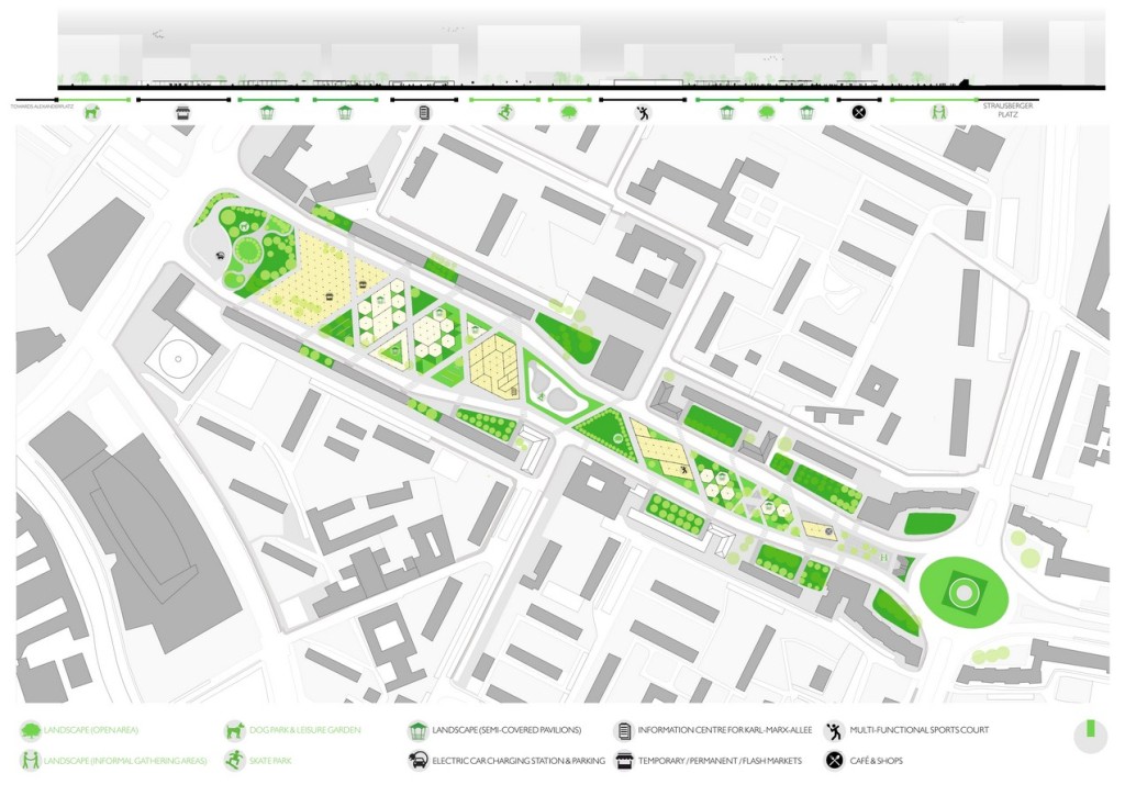
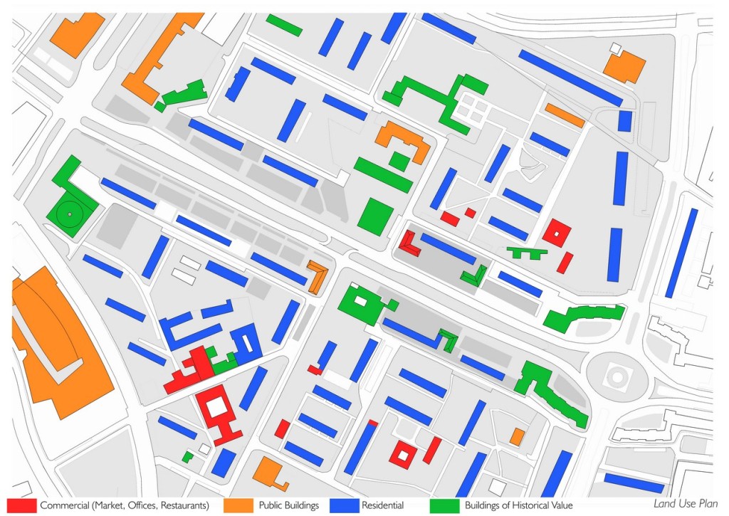
MASTERPLAN: The zoning of landscape areas are further divided into three types – private, semi-private and public. The private landscape areas are the new shared spaces between the neighbourhoods. The semi-private spaces are covered pavilions and decks that are interconnected to each other using the same cross-grid pathways that connects apartment blocks on either side of the boulevard. The public open spaces link the city of Berlin with the boulevard on various fronts – the west end of the boulevard links back to Alexanderplatz, landscape areas in front of the Kino act as interactive and engagement hotspots, the east end of the boulevard has landscape areas and seating benches for office employees from Haus Berlin and Strausbergerplatz.
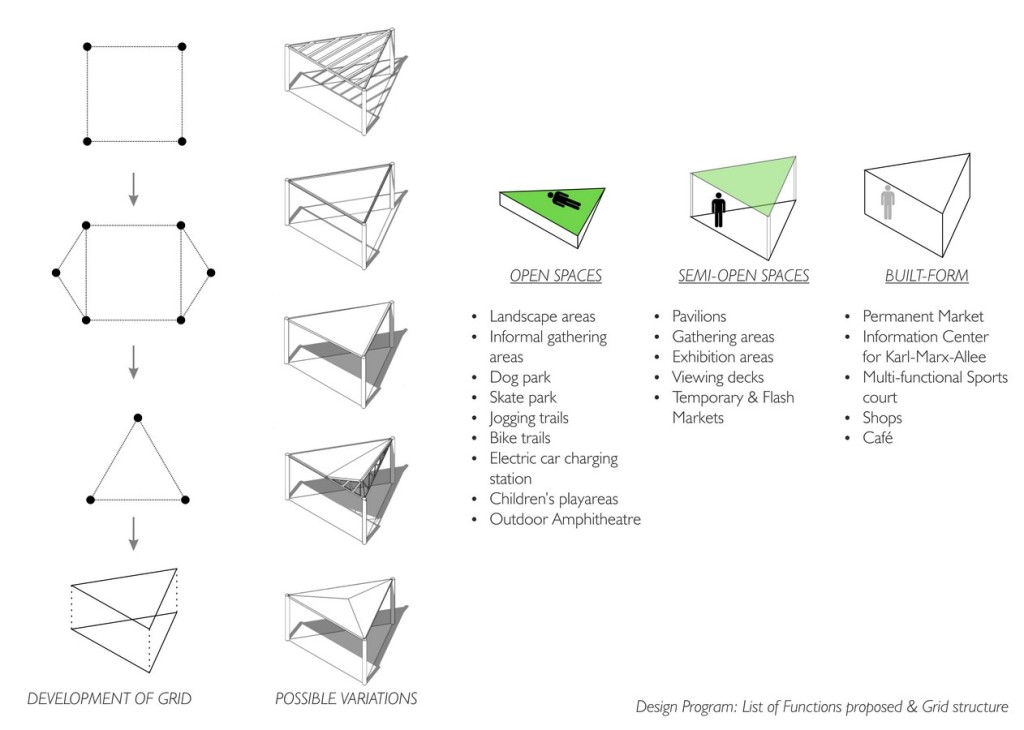
In terms of built form, there are few fixed structures added on the boulevard so as to retain the grandeur of the original Karl-Marx-Allee skyline. No structure that has been added is more than a single-storey structure. The architecture buildings are designed upon a triangular grid of 8m on each side, allowing more structural stability and free modulation for additions. A temporary market has been proposed on the west of the boulevard, with the triangular grid of 8m acting as a skeleton framework to add and remove stalls. On the west of the Kino, is an exhibition center proposed that gives information and celebrates the historic boulevard. On the east of the Kino is a multi-functional sports facility that caters to the lack of sports infrastructure within the neighbourhood.
A clear hierarchy of open to semi-open to semi-built to built space can be seen progressing along the boulevard as we move from Alexanderplatz to the center of the boulevard. The same effect is then mirrored from center to the east end, thus creating a natural hierarchy of spaces.
The new boulevard will become a model for future Urban social spaces that reconquest the car infrastructure that has divided urban neighbourhoods. Specific contexts will lead to unique programs, however the method of repairing the broken links maybe inspired from the new Karl-Marx-Allee

Hamed Khalidi
Hamed Khalidi is a current Masters student in the Dessau International Architecture (DIA) School at Hochschule Anhalt University, Germany. He completed his Bachelor’s degree from University of Mumbai, India in 2010. As a student, he has participated in various student competitions, winning the prestigious ‘Translating Traditions’ supported by the Berkeley Prize Architectural Design Fellowship. In the following years, he worked under the tutelage of India’s finest architects including the late Charles Correa (Mumbai), Nimish Patel & Parul Zaveri (Ahmedabad) and Kiran Kapadia (Mumbai). His portfolio reflects a wide array of projects ranging from Institutional, Hospitality, Residential and Masterplanning projects. His project ‘Vision for Karl-Marx-Allee, Berlin’, as part of his first Semester of his Masters program, was part of a studio program that dealt with the aging issue of overprovided car infrastructure in Germany. The core concept of the project was to create an ‘Urban Social Space’ that will become a model for future Urban spaces, reconquesting the car infrastructure that has divided urban neighbourhoods.