This project concerns cities like Dubai in the United Arab Emirates, which have come to occupy a central place in the global economy. For reasons of resource scarcity and the projected effects of desertification around the globe, Dubai and similar cities are vulnerable and can threaten global economic stability. This project proposes a new urban planning strategy and a prototypical desalination infrastructure to mitigate social and climatic threats, provide jobs, create long-term economic viability, and stabilize the future of a city of over two million inhabitants on which the global economy relies.
Architect: Robert Mosby
Country: United States
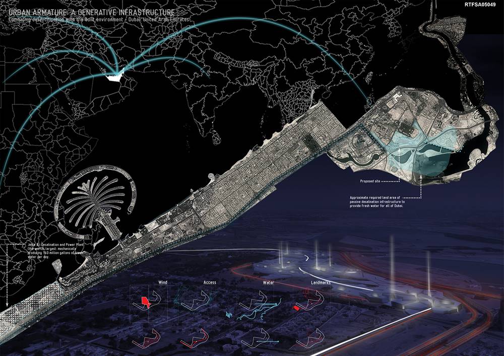
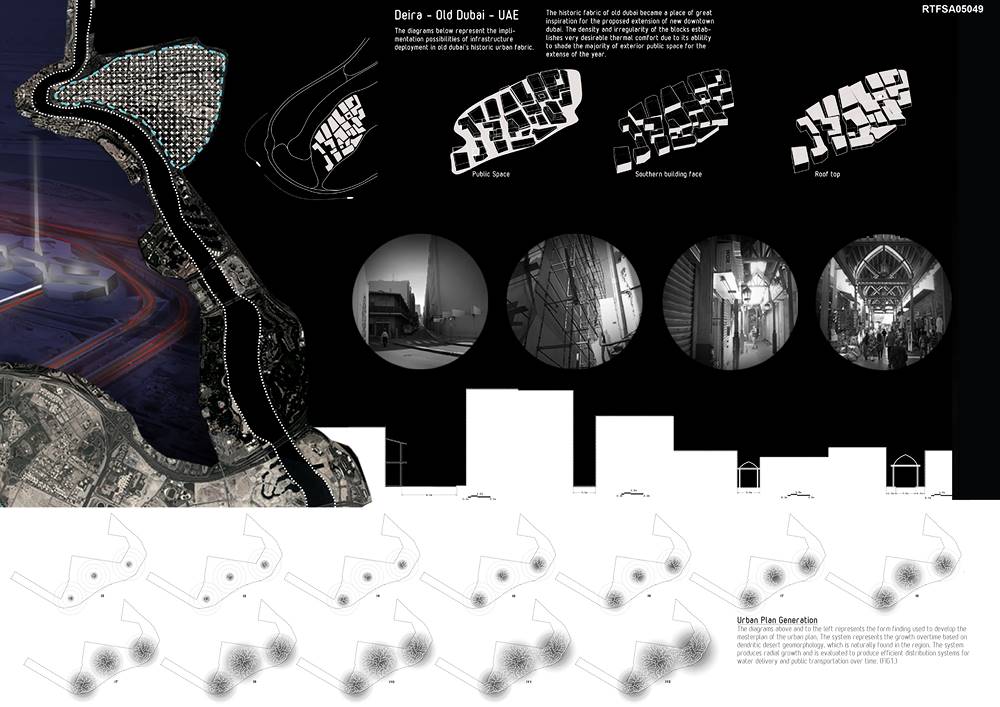
The investigation began with an analysis of historical desert cities, specifically Dubai’s historical fabric located at the mouth of Dubai Creek (Pg 3). The area is the only remaining plot in Dubai that is represents urban density and is a representation of real life in Dubai. The streets are narrow, irregular and lively with pedestrian traffic, unlike the linear and sprawling ‘New Dubai’ located along Sheikh Zayed Road and home to the heart of the immigrant population that makes the city run.
The second form of inspiration for the master plan was the dendritic watershed, a form of desert geomorphology found in the region. The system originates at a source and flows on a path of least resistant creating a branch like structure of water distribution. The combination and generation of these two systems form an urban master plan producing density, irregularity and a form of efficiency that can grow over time if unbounded. The system can also respond to population influx while maintaining a rational infrastructural system. For example, as the branches grow they are supplied with water from nodes at the origin of the branching system. The nodes are connected by the largest distribution line, which brings in brine (waste product of desalination) from the Jebel Ali desalination plant and also seawater from Dubai Creek for processing. Another connective feature are the radial streets that are populated every 100m creating connections between the branches for pedestrians. The system was also evaluated to find the quickest way to the periphery of the growth, establishing both major water distribution and street infrastructure (Pg. 4 & 5). The development is vechicular free except on designated streets for bringing goods in and out. Most traffic happens on the periphery of the development.
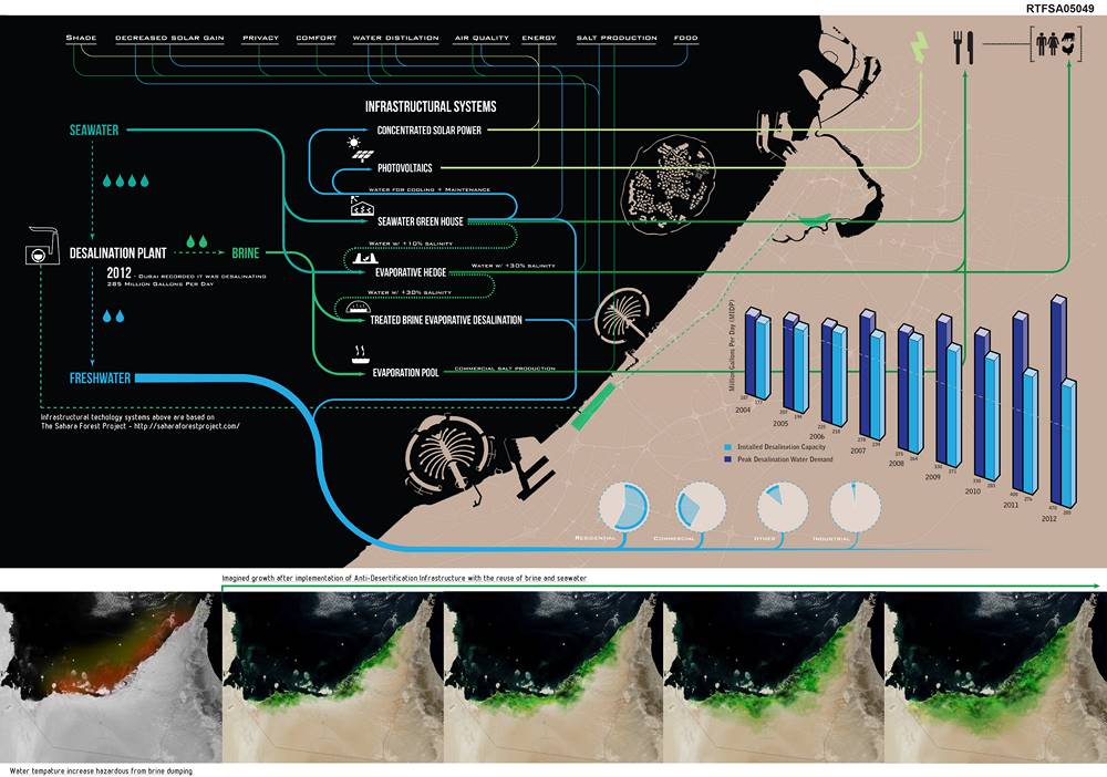
As seawater and brine move through the established system they terminate at infrastructural zones are integrated into daily life. They include seawater green houses, brine desalination domes, evaporative salt pools, and also passive desalination domes (Pg. 6). Once seawater and brine is processed freshwater is redistributed to other areas of the urban plan. The goal is to provide freshwater and food without the reliance of mechanical desalination for the new proposed area Dubai as a whole. In addition, the project is creating a model for desert living that eliminates the need for mechanical desalination, reliance on food imports, and dumping of hazardous brine back into the Persian gulf.
In
Urban Design
Urban Armature Combating Desertification with the Built Environment | Robert Mosby
3 Mins Read
Prev Post
Xincunsha Master Plan | Sasaki Associates
3 Mins Read


